Looking for a peaceful escape into the mountains? Wangedigala is where adventure meets serenity—perfect for hikers, campers, and nature lovers in Sri Lanka’s highlands!
Discover the Beauty of Wangedigala
Looking for a peaceful escape into nature with a touch of adventure? Wangedigala is the perfect camping and hiking spot hidden in Sri Lanka’s central highlands. This hike offers stunning views, fresh mountain air, and a great camping experience for those who love the outdoors.
This trail is moderately difficult, taking about 3 to 4.5 hours to reach the top, depending on your fitness level. But once you’re up there, the beautiful sights and calm atmosphere make every step worth it.

Helpful Tips for Your Wangedigala Trip
💧 Bring Enough Water:
- Drinking water is a must. During the dry season, water sources may dry up. So, bring enough water for the whole trip.
🌧 Be Ready for Rain:
- The weather can change quickly. Carry a raincoat, a waterproof tent, and a gas stove.
- If you want to make a campfire, bring some dry firewood, especially if the campsite is crowded.
🥾 Shoes and Leech Protection:
- The first part of the hike is steep.
- In rainy seasons, there may be leeches. Wear strong, covered shoes and long socks.
☀️ Check the Weather Before You Go:
- Knowing the weather helps you pack better.
- Don’t forget to bring a jacket—it gets cold at night!
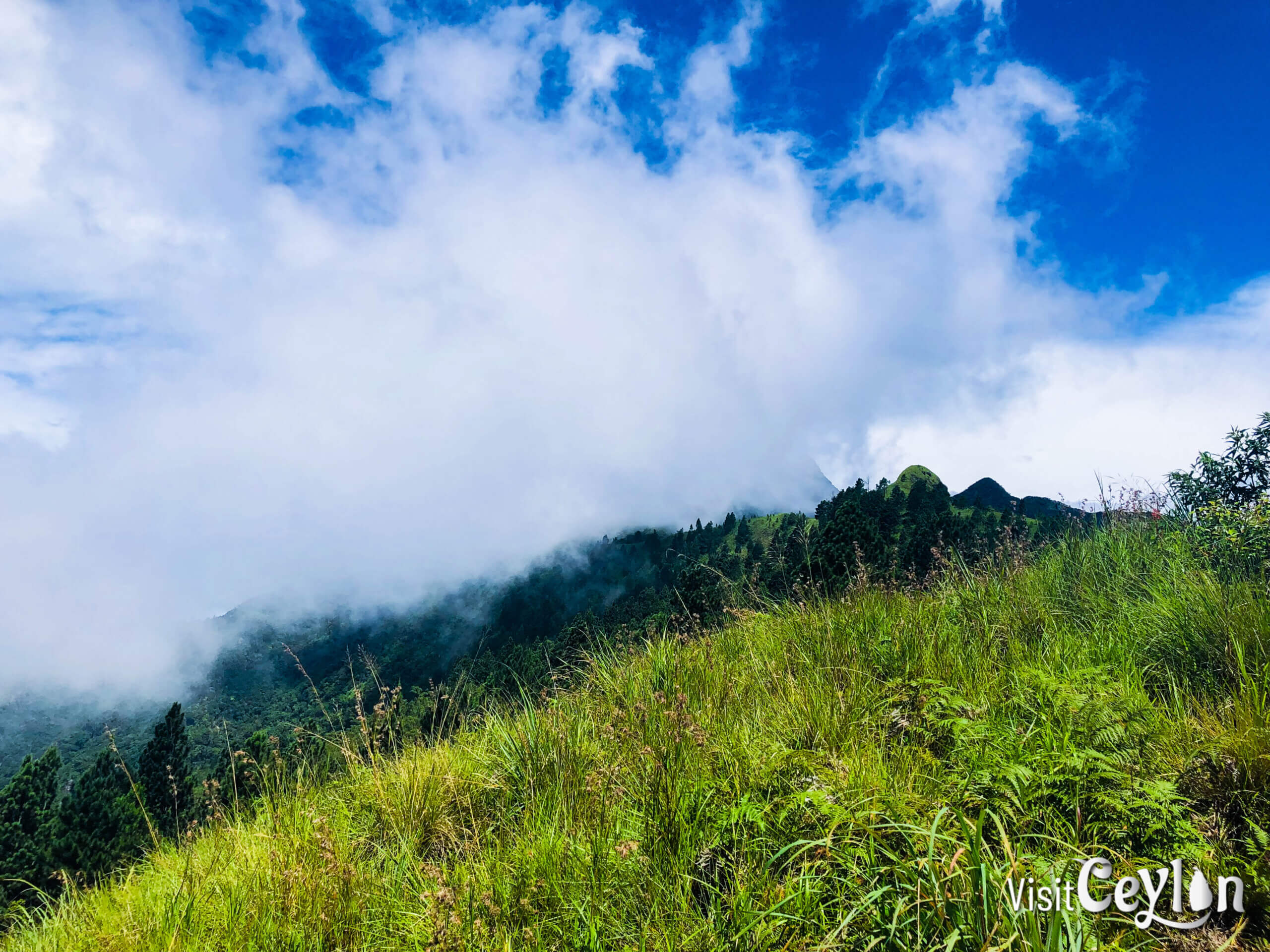
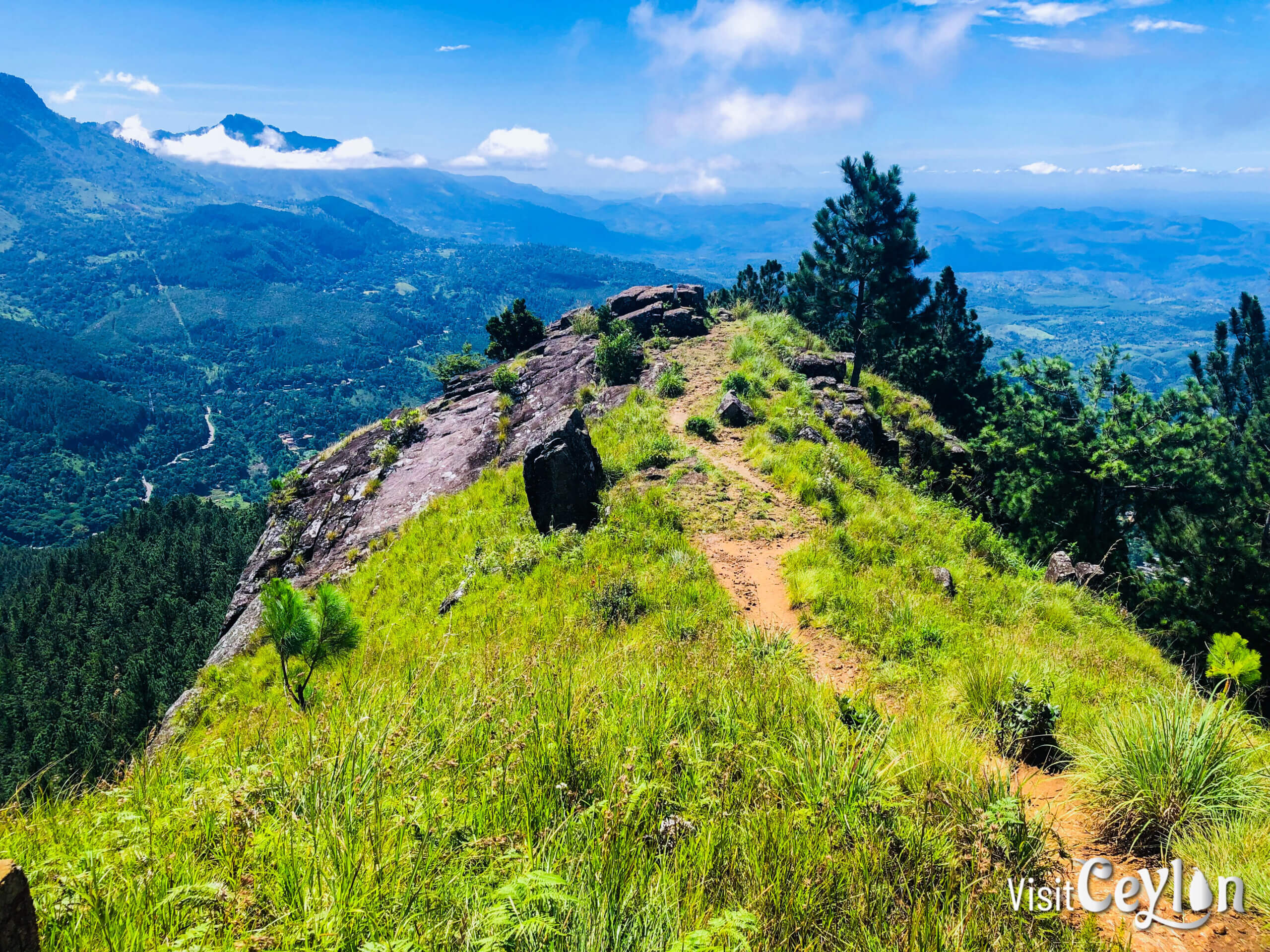
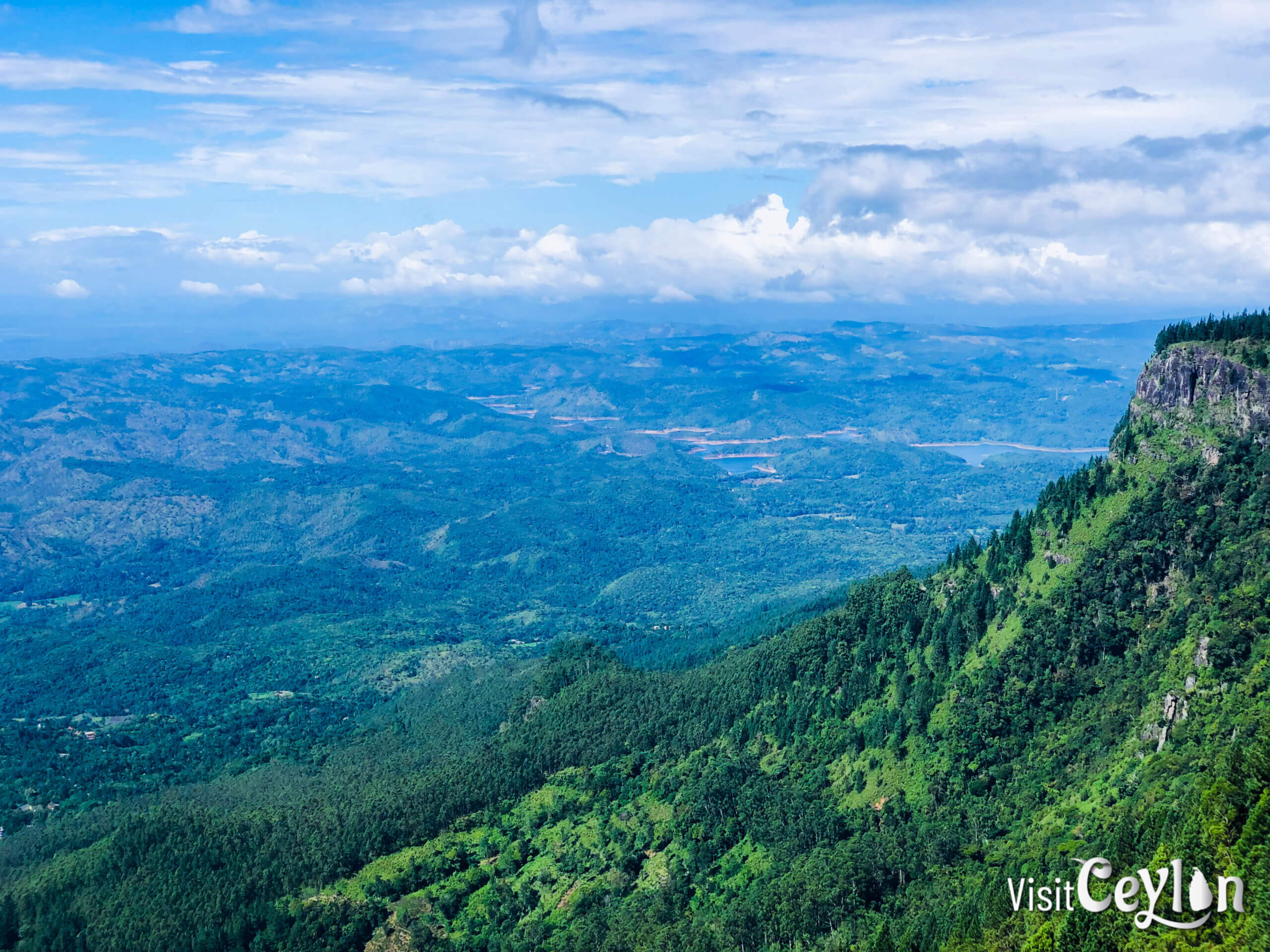
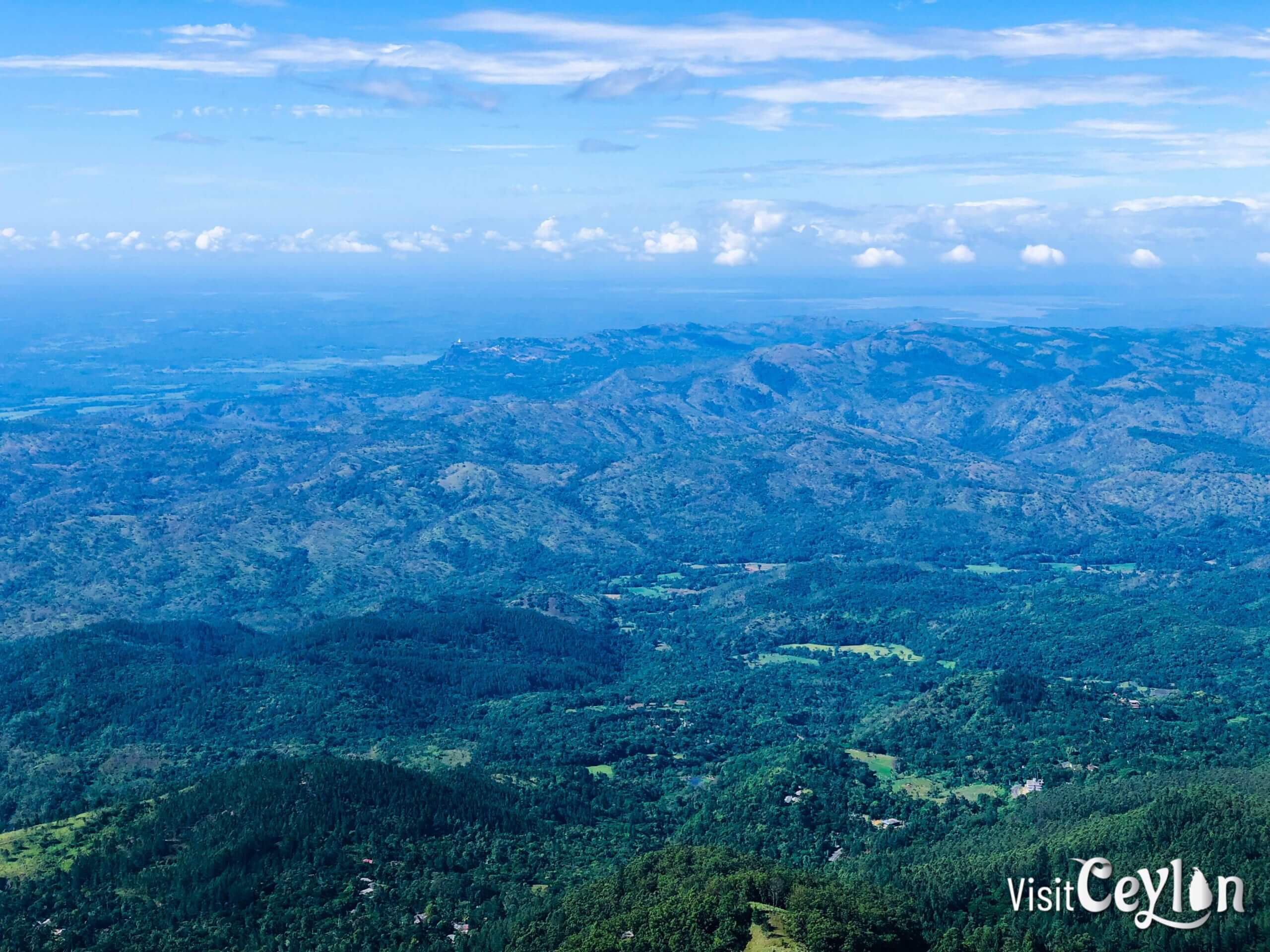
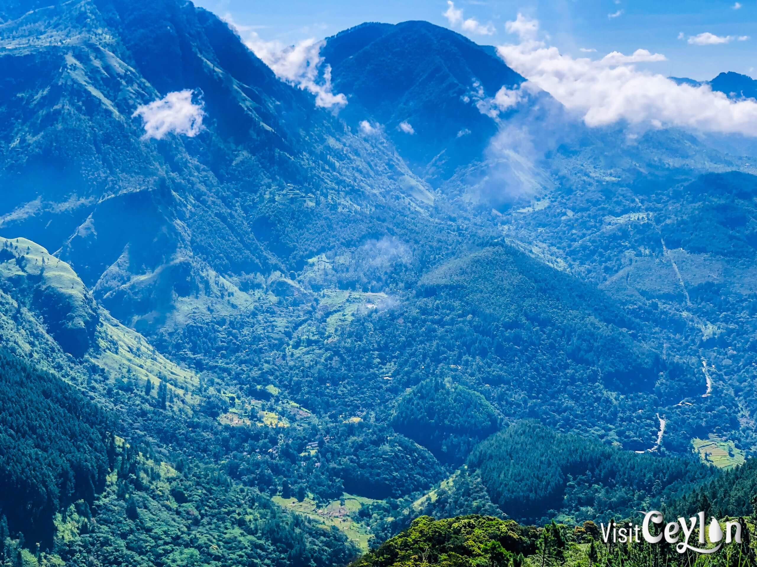
Amazing Views from the Top
At the summit, you’ll be greeted with wide views of the mountains and valleys. You can see:
- The famous World’s End cliff
- Bambarakanda Falls (Sri Lanka’s tallest waterfall)
- Weli Bend (Weli Wanguwa)
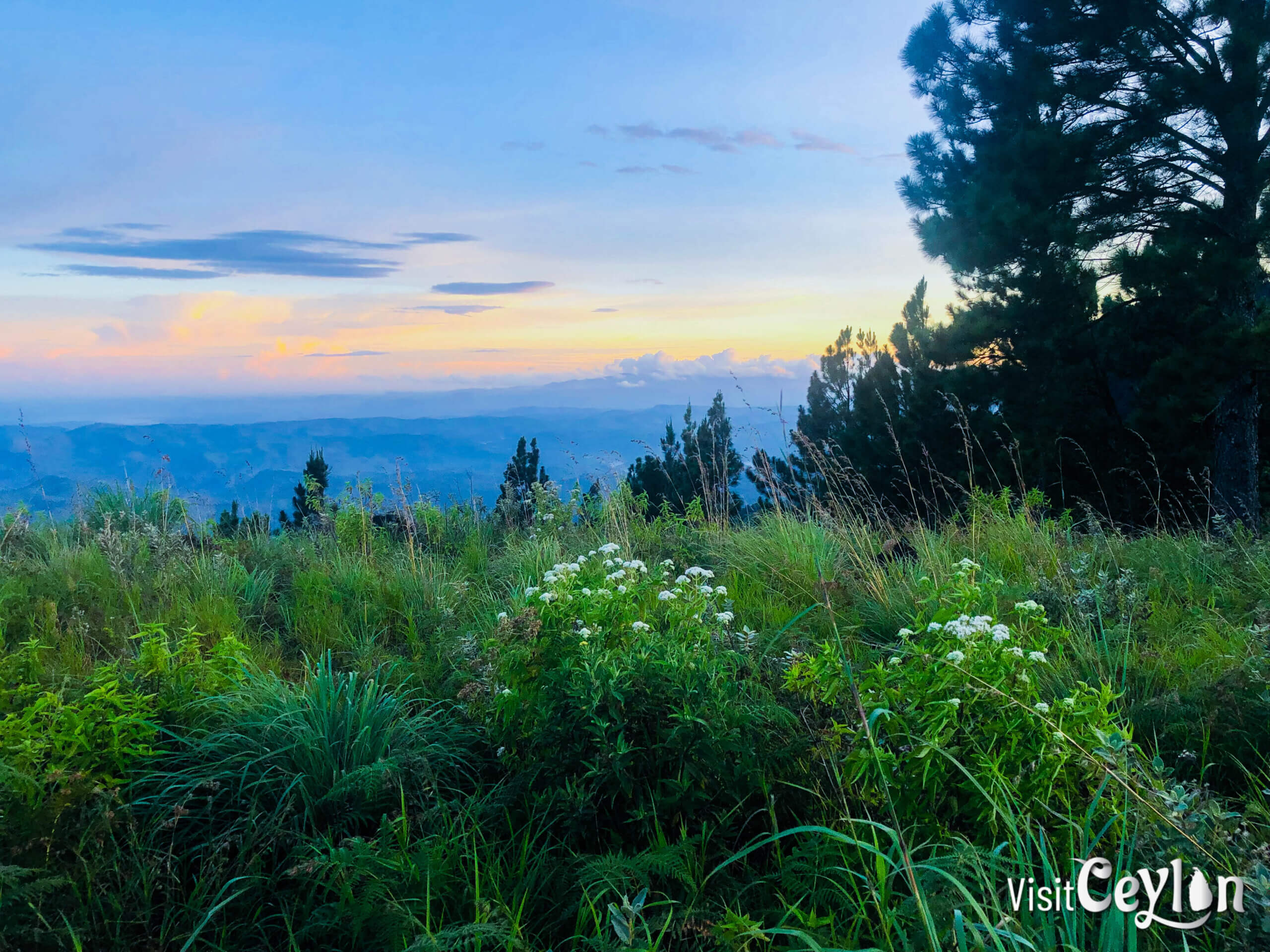
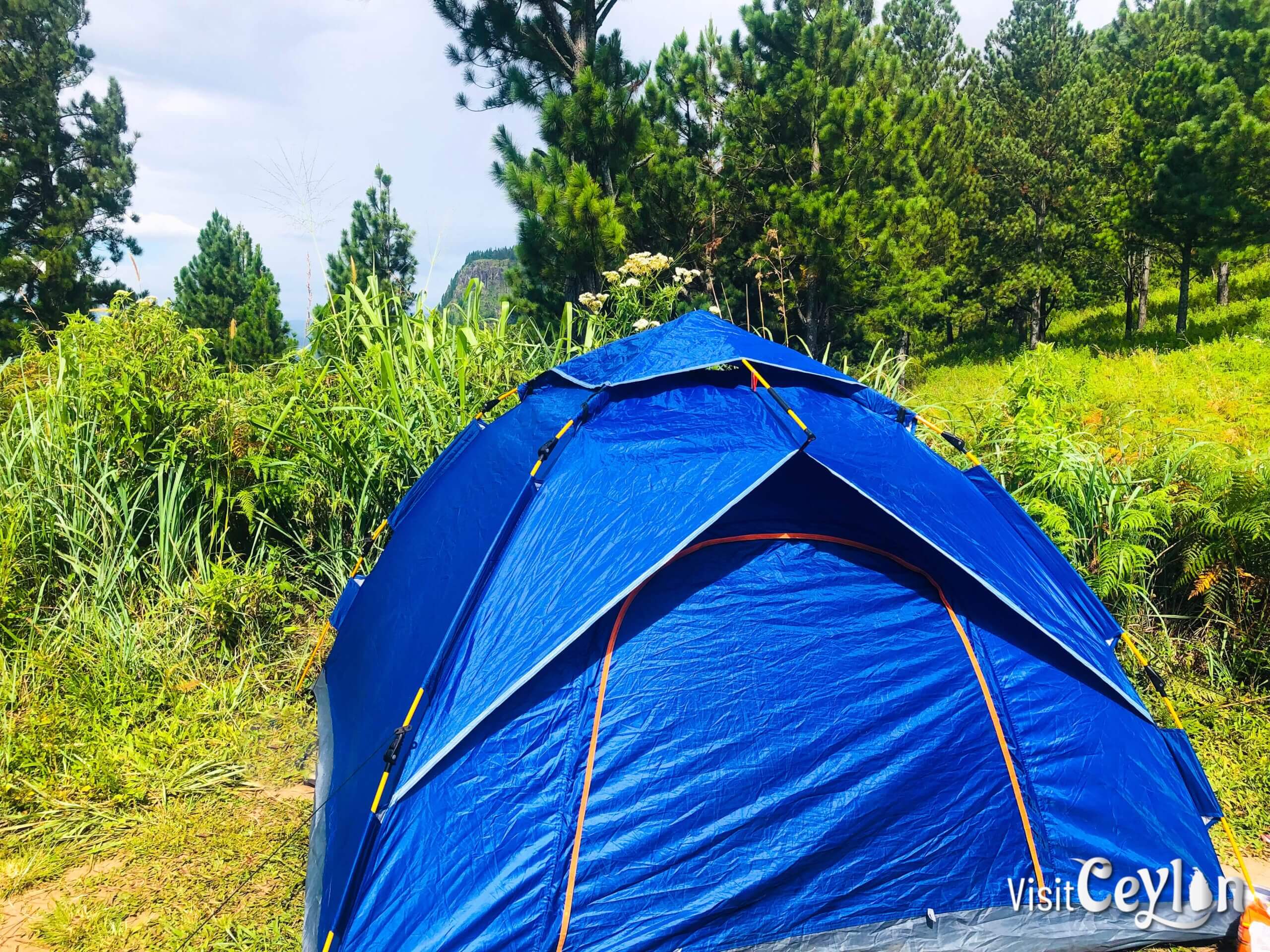
Camping at Wangedigala
🏕 The Campsite:
- Nights can be chilly, so pack warm clothes.
- There’s plenty of space, even when multiple groups are camping.
- One drinking water source is about 200 meters downhill.
- Another small water spot is near the site—check it out in the video!

Hiking Routes to Wangedigala
Choose a path that suits your level of fitness and adventure:
1: From Bambarakanda Falls
- Time: About 3.5 hours
- Highlights: Starts at the base of the beautiful Bambarakanda Falls. This is the most popular and direct trail.
2: From Kalupahana
- Time: 5–6 hours
- Highlights: Walk through peaceful countryside, villages, and maybe even spot wildlife.
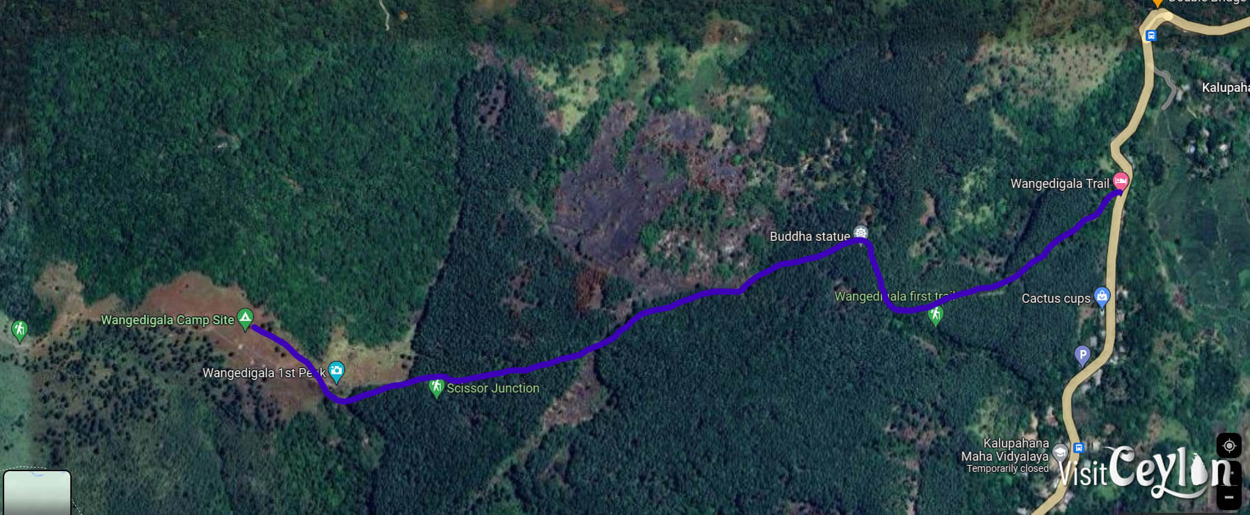
3: Wangedigala First Trail (from Weli Oya Bridge)
- Time: About 3 hours
- Highlights: A direct trail with pine forests and rocky paths. Great views and a fun hike for nature lovers.
Go Beyond – Climb More Peaks!
If you love a good challenge, don’t stop at Wangedigala. Go for the full mountain adventure by reaching:
- Wangedigala Second Peak
- Balathuduwa Peak
- Gommoliya Peak
These climbs are tough, but the views and the sense of achievement are worth it!
Final Thoughts: Leave Only Footprints
Wangedigala is a place of beauty. Let’s keep it that way:
- Take all your trash back with you.
- Respect nature and other campers.
Whether you’re here for the views, the hike, or the peaceful mountain air, Wangedigala offers a memorable escape into the wild.
👉 Watch our video for a closer look at the journey and the campsite!
📌 Save this post and share it with your adventure-loving friends! 🏞️✨
Plan Your Adventure: Explore Our Interactive Map!
To make your journey even easier, check out our interactive map, where we’ve marked all these amazing destinations. Use it to plan your trip and discover more hidden gems in Sri Lanka!
To plan your trip with public transportation in Sri Lanka, visit Sri Lanka Railways for train schedules.
For your reference, I will put the Wangedigala First Trail (from Weli Oya Bridge) route GPS coordinates in GPX format.